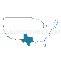
Concho Valley COG & Permian Basin Regional Planning Commission (East) PUMA, Texas
About
** Data sources from census 2010 **
Maps
Graphs
Neighbors
Neighoring Public Use Microdata Area (by Name) Neighboring Public Use Microdata Area on the Map
- Alamo Area COG (Northwest) & Blanco County PUMA, TX
- Central Texas COG (West), Burnet & Llano Counties PUMA, TX
- Concho Valley COG--Tom Green County--San Angelo City PUMA, TX
- Middle Rio Grande Development Council PUMA, TX
- Permian Basin Regional Planning Commission (Central)--Ector County--Odessa City PUMA, TX
- Permian Basin Regional Planning Commission (Central)--Midland County--Midland City PUMA, TX
- Rio Grande COG & Permian Basin Regional Planning Commission (West) PUMA, TX
- South Plains Association of Governments (Outside Lubbock County) PUMA, TX
- West Central Texas COG (Outside Taylor County) PUMA, TX
Top 10 Neighboring County (by Population) Neighboring County on the Map
- Ector County, TX (137,130)
- Midland County, TX (136,872)
- Tom Green County, TX (110,224)
- Kerr County, TX (49,625)
- Val Verde County, TX (48,879)
- Brown County, TX (38,106)
- Howard County, TX (35,012)
- Gillespie County, TX (24,837)
- Llano County, TX (19,301)
- Gaines County, TX (17,526)
Top 10 Neighboring County Subdivision (by Population) Neighboring County Subdivision on the Map
- Midland CCD, Midland County, TX (119,500)
- Odessa CCD, Ector County, TX (111,306)
- Big Spring CCD, Howard County, TX (30,743)
- Brownwood CCD, Brown County, TX (26,048)
- West Tom Green CCD, Tom Green County, TX (25,405)
- Midland South CCD, Midland County, TX (17,372)
- Fredericksburg CCD, Gillespie County, TX (16,947)
- Seminole CCD, Gaines County, TX (14,015)
- Andrews North CCD, Andrews County, TX (12,075)
- Lamesa CCD, Dawson County, TX (11,998)
Top 10 Neighboring Place (by Population) Neighboring Place on the Map
- Midland city, TX (111,147)
- Big Spring city, TX (27,282)
- Lamesa city, TX (9,422)
- Brady city, TX (5,528)
- Ozona CDP, TX (3,225)
- Sonora city, TX (3,027)
- Big Lake city, TX (2,936)
- Eden city, TX (2,766)
- Junction city, TX (2,574)
- Stanton city, TX (2,492)
Top 10 Neighboring Unified School District (by Population) Neighboring Unified School District on the Map
- Ector County Independent School District, TX (137,130)
- Midland Independent School District, TX (129,655)
- San Angelo Independent School District, TX (94,460)
- San Felipe-Del Rio Consolidated Independent School District, TX (48,272)
- Big Spring Independent School District, TX (29,015)
- Fredericksburg Independent School District, TX (21,951)
- Llano Independent School District, TX (16,958)
- Snyder Independent School District, TX (15,627)
- Andrews Independent School District, TX (14,786)
- Seminole Independent School District, TX (14,399)
Top 10 Neighboring State Legislative District Lower Chamber (by Population) Neighboring State Legislative District Lower Chamber on the Map
- State House District 73, TX (187,204)
- State House District 83, TX (173,230)
- State House District 82, TX (163,234)
- State House District 81, TX (159,026)
- State House District 60, TX (148,990)
- State House District 71, TX (146,722)
- State House District 53, TX (145,845)
- State House District 74, TX (143,566)
- State House District 85, TX (143,267)
- State House District 72, TX (139,868)
Top 10 Neighboring State Legislative District Upper Chamber (by Population) Neighboring State Legislative District Upper Chamber on the Map
- State Senate District 24, TX (778,148)
- State Senate District 19, TX (766,044)
- State Senate District 31, TX (727,115)
- State Senate District 28, TX (704,340)
Top 10 Neighboring 111th Congressional District (by Population) Neighboring 111th Congressional District on the Map
- Congressional District 21, TX (856,954)
- Congressional District 23, TX (847,651)
- Congressional District 11, TX (710,682)
- Congressional District 19, TX (698,137)
Top 10 Neighboring Census Tract (by Population) Neighboring Census Tract on the Map
- Census Tract 101.12, Midland County, TX (11,417)
- Census Tract 101.13, Midland County, TX (9,514)
- Census Tract 9502, Gaines County, TX (8,643)
- Census Tract 30, Ector County, TX (8,541)
- Census Tract 9603.02, Kerr County, TX (7,942)
- Census Tract 101.09, Midland County, TX (7,858)
- Census Tract 17.04, Tom Green County, TX (7,661)
- Census Tract 9503, Gillespie County, TX (7,104)
- Census Tract 9508.02, Howard County, TX (6,703)
- Census Tract 9501, Garza County, TX (6,461)
Top 10 Neighboring 5-Digit ZIP Code Tabulation Area (by Population) Neighboring 5-Digit ZIP Code Tabulation Area on the Map
- 79720, TX (33,640)
- 79705, TX (33,536)
- 79707, TX (32,854)
- 76904, TX (32,718)
- 76901, TX (27,969)
- 78624, TX (21,513)
- 79706, TX (19,571)
- 79549, TX (15,652)
- 79714, TX (14,786)
- 79735, TX (13,315)


+PUMA%2c+Texas_A280.png)

+PUMA in Texas.png)

+PUMA%2c+Texas_T0.png)
+PUMA%2c+Texas_T1.png)
+PUMA%2c+Texas_T2.png)
+PUMA%2c+Texas_T3.png)
+PUMA%2c+Texas_T4.png)
+PUMA%2c+Texas_T5.png)
+PUMA%2c+Texas_T6.png)
+PUMA%2c+Texas_T7.png)
+PUMA%2c+Texas.png)